Emergency & long term waterbody response planning
Long Island Sound's feeder streams — its "arteries" — are occluded by a century of piped runoff, while more than 90% of the Sound's salt marshes have been removed. This program recovers those runoff deposits by amphibious suction dredging and re-uses the clean yield as the base material to rebuild marsh, barrier islands, and stabilized stream banks.
Prepared by CoastalReVitalization (CReV) L.L.C. — Peter F. Alexander, Landscape Architect Planner, CT 470 / NY 989.
Three outcomes at the same time
The health of Long Island Sound is based on the health of its salt marshes — osprey, ribbed mussel, saltmarsh grass, river herring, smooth cordgrass, killifish, snowy egret, and blue crab all depend on them.
Restored stream capacity
Flood and drought attenuation — clear the arteries and the watershed holds water again instead of shedding it.
Rebuilt salt marsh
Carbon storage, habitat, and wave diffusion — marsh rebuilt with the very material the arteries give back.
Tested, cleansed material
Toxins identified and treated, not relocated — every cubic yard is analyzed before it is re-used.
Long Island Sound, Greenwich, and the Byram River system
North-south valleys feed an east-west waterbody. Roughly 90% of tidal input arrives from the Atlantic Ocean; the remainder enters through Throgs Neck. A 150-mile barrier island — Long Island — encloses the system, and water quality is compromised by pollution from populated areas: fresh meets salt, and everything upstream arrives here.
Basic understanding of the sub-watershed is critical to long-term flood planning. Work is prioritised artery by artery, not parcel by parcel:
Byram • Greenwich • Bruce • Rivercob • Old Greenwich
The pilot corridor runs from Port Chester, New York to Stamford, Connecticut — a five-year-term master plan project.
Training site key — Long Island Sound Revitalization
- 1School. Artery restoration — youth training potential site.
- 2Dam. Modern improvements for anadromous & diadromous fish; bank planting for migratory avian & insect species — staging area.
- 3Occluded stream. Artery cleansing method site.
- 4Fresh water marsh. Artery cleansing method site.
- 5Compromised salt marsh. Artery cleansing method site. Sites 3–5 hold centuries of heavy minerals plus 20th and 21st century chemicals that are easily identifiable and treatable.
- 6Long Island Sound. Tidal influenced waterway. The Connecticut watershed essentially ends at the New York / Connecticut border.
Located and analysed with precise location software and modern bathymetry to map silt accumulation.
Paved runoff, clogged arteries, and a river that floods on a small rain
Change with no change — roads to ruin
The increase in roadway area has dramatically changed both the amount and the speed of runoff. A tiny amount of rain now creates flood conditions, and the quality of life for a wide variety of species — humans included — has suffered for it.
Discharge curves tell the story: full development with only stream restoration spikes hardest and fastest; development combined with infiltration and restoration flattens the same storm into a manageable curve. Permeable paving and the slowing of runoff can be carried out with very little disruption.
Byram River gauge data — USGS 01212500 at Pemberwick
The rain stops, and less than an hour later river height and volume drop. That flashiness is the signature of a piped, paved watershed with no storage left in it. Detention, retention and infiltration convert that spike back into base flow — which is also the answer to drought, not only to flood.
Long Island Sound's treasure — and its critical loss
More than 90% of the Sound's salt marshes have been removed. The compromised marshes that remain are the last buffer between the watershed's paved runoff and the open Sound.
Recover the runoff deposits. Test them. Dewater them. Rebuild the marsh with them.
Salt marsh reconstruction — from storm log line to mean high water
Harvested 100-year-old trees become the vertical storm log lines set under mean high water in the reconstructed marsh — nothing leaves the watershed.
Barrier marsh / shellfish protection plan
Proposed CReV barrier marsh site plan — Shell & Calf Island, Greenwich, CT — pairs marsh reconstruction with shellfish protection.
Dewatering through geotextiles — then placement
Delivery to the marsh is by skiff-carried biodegradable textile tubes, and in some settings by floating pump systems with a one-mile range.
Dams & fish passage on the Byram River
Three dams on the Byram River are risk and opportunity at once — anadromous and diadromous access channels use Jersey barriers to stabilise the fish channel sides.
Upstream controls — filter berms, infiltration beds and bioswales
Filter berms and infiltration trenches slow runoff at the source, flatten the storm curve, and keep the downstream arteries from re-clogging.
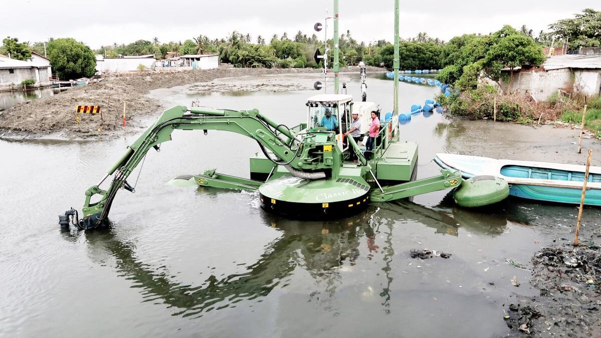
Watermaster V — amphibious, multi-function, self-propelled
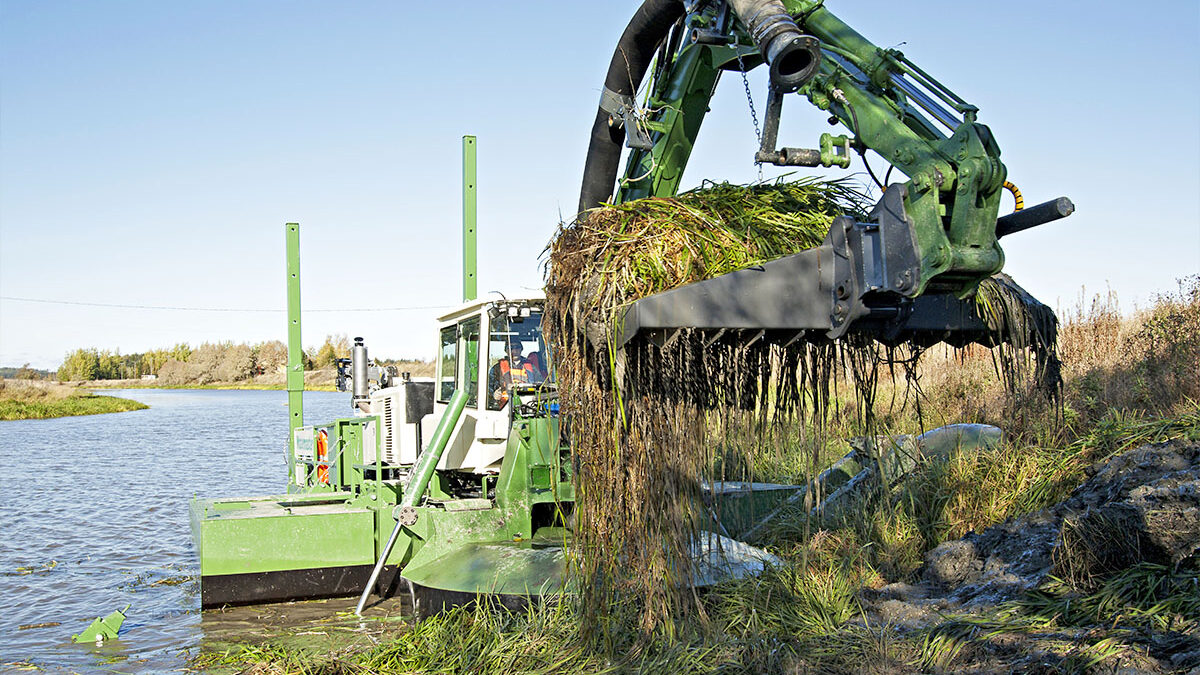
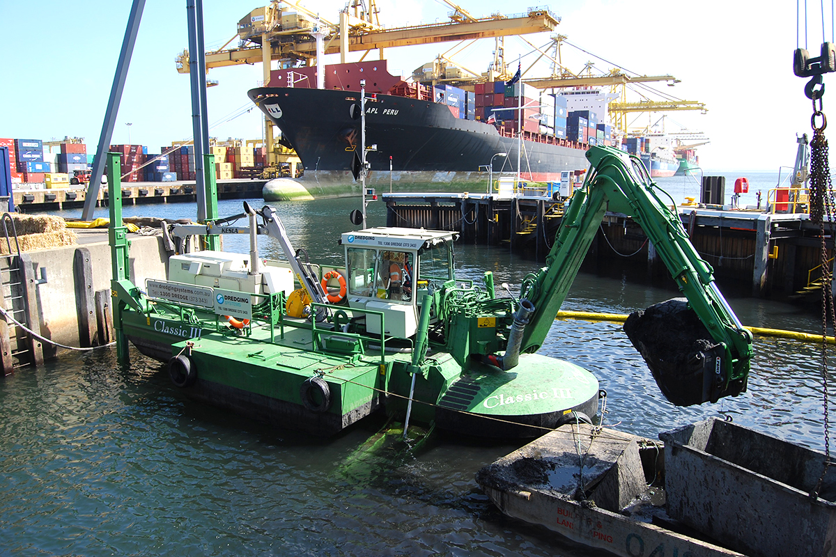
One amphibious machine, a transport chain, and the tools that let it work anywhere in the watershed. General suction dredging for silt, sand, mud, sludge and gravel — with the ability to treat toxins and purify runoff.
10 ft
maximum width — gentle access & egress
24 in
hydraulic cutter head, engineered in Finland
10 in
discharge line
1,000 cy/hr
yield, pumped up to one mile
4 in
rock size capability
200 ft+
working range for sensitive areas
What the machine itself does
- 1Works in tight areas. Beneath a masonry bridge arch: 10 ft width and self-propelled walking give access where barges and land plant cannot reach.
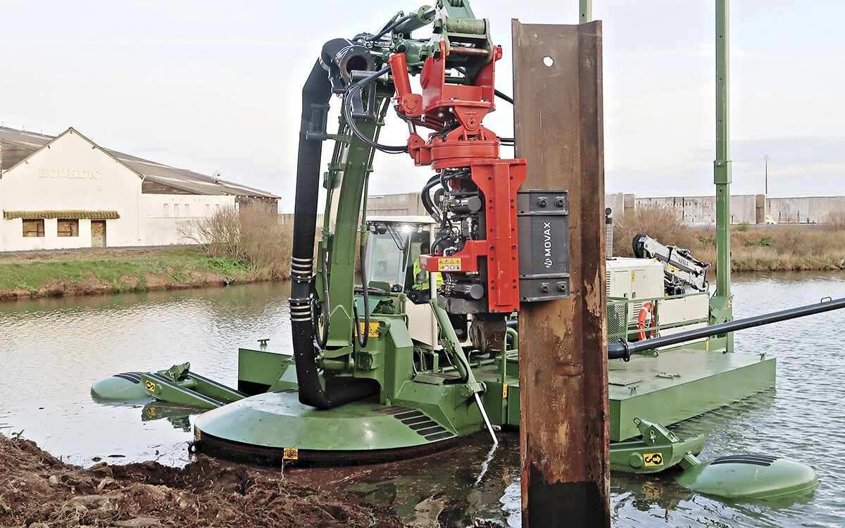
- 2Long term bank stabilization. Movax vibratory pile driver setting shore piling from the water, with the dredge working the same reach.
- 3Temporary stabilization by tree centre. Bank work staged so planted species take over long-term stabilization as they establish.
- 4In and out of all areas. Amphibious walking access and egress — it enters and leaves the water under its own power, with no ramp, barge or crane.
- 5Power to distribute its own yield. Direct siphon discharge — up to 1,000 cubic yards per hour, pumped up to one mile from the cut.
- 6Meets US highway standards. Highway-transportable: the machine walks on and off its own trailer.
Stream cleaner — prescribed gear
- Backhoe rake — 9 ft. Removes invasive vegetation from lake and stream by raking, without excavating the bed.
- Piling driver bucket. Sets wood piles for storm log lines and bank works.
- Movax vibratory pile driver. Post-storm piling borders and permanent shore stabilization.
- Tree spade. Moves vegetation temporarily for access, then replants — and can revitalize plants suffering from silt-caused higher water-table elevation.
- Cutter head — 24 in. General suction dredging of silt, sand, mud, sludge and gravel.
Access & reach. The stream cleaner transport chain pairs a tractor unit with a 65-foot boom truck and low-bed trailer — highway rated 1.5 tons at 65 ft — able to transfer either toxic or clean yield out of occluded streams, or cleanse and repurpose the yield on site for retention berms. Scissor telescope booms combine the 25 ft Watermaster boom with a 65 ft boom truck and up to a 200 ft scissor lift for long reaches and difficult terrain.
Forestry. The tree mover and trailer-mounted lumber processor provide flood-amelioration swale and berm pilings by selective harvesting — the harvested timber becomes the storm log lines of the reconstructed marsh.
On & offshore. The project vessel — full galley, head, cabin and berths — doubles as site housing and data-collection station, while the survey & launch skiff shares capacity with the Watermaster to beach, receive and disperse supplies ashore for marsh and island restoration.
Greenwich Harbor and the Byram River park system
Byram River park system — six linked parks
- Toll Gate Ponds Park. Pond restoration and silt trapping; siltation has filled the pond, raising the water table 2 ft to 3 ft in most cases.
- Glenville Riverside Park. Riverside road walk on the Merritt Parkway alignment; riverbank access and planting.
- Caroline Munsee Park. Silt-trapping streamway, deep-water fishing hole and recreation areas at the existing pond edge.
- Lyon House Park. Thomas Lyon Homestead Park at the state line; the Byram River is the border between CT and NY.
- Riverwalk Park. River walks and bicycle trails; dredge the river and use the material to build the trail system.
- Byram River Valley. West and east branches feeding Long Island Sound at Port Chester / Greenwich.
A trail system is to be created throughout the watershed for bikers, people and horses. Each plan pairs a silt trap with a public amenity: restore the artery, and the park pays for its own maintenance in reduced downstream flooding.
Greenwich Harbor — restoration study area
Infrared aerials overlay the 2009 coastline against 1934 and 1965. The study area keys the Horseneck Brook outflow, a proposed silt trap, park expansion with dredge material, restored salt marsh, the Grass Island Treatment Plant, and restored salt water inflow-outflow. Natural and human melding here has a now-understood history of more than 1,000 years, precisely located with GIS and three-dimensional monitoring of harbor condition before, during and after.
2023 / 2024 / 2025 harbor improvements — program
- aTest results analysis. Analysis and storage in a climate-controlled, limited-access facility.
- b2012 test results. Comparison study against the current sampling round.
- cInner harbor master plan. Based on (a) and (b), with State, Federal and local protocols.
- dTimeline & budget. 8/1/2023 start date. Test bidding to mirror USACE / CT DEEP, or provide duplicates to same. $250,000 US with a $25,000 retainer directly from the Town of Greenwich; all expenditures require joint approval post-retainer.
- eRoutine maintenance & storm response. Decrease channel occlusion through a silt trap system and restored salt marsh, with potential to use harbor yield in conjunction with the NFWF grant program to restore salt marshes.
Pilot marsh project. A full submission set — vicinity map, existing conditions, cross sections, and proposed conditions — is drawn to consistent scales so the placed volume is auditable against the permit.
The outcome — the New England lagoon. Tidal influenced waterways separating salt marsh areas can be profound for both ecological vitality and storm attenuation — and it is precisely what this coastline once had, and can have again.
From first look to five-year master plan
Satellite assessment
First look at the whole watershed from above — where the arteries are occluded and which ones matter most.
↓
Master plan & budget preview
Artery-by-artery work plan with budget preview, not parcel by parcel.
↓
Bathymetry & testing
Modern bathymetry and precise location software map silt accumulation; testing identifies and treats toxins.
↓
Pilot works
A first corridor is dredged, dewatered and rebuilt as marsh — auditable against the permit.
↓
Maintenance & storm response
Silt traps, restored marsh and a standing crew keep the arteries open for the five-year term and beyond.
Revitalization, not relocation
Fifty years of wetlands regulation have succeeded remarkably. Centuries of dealing with floods and droughts have never been safer or easier to manage. What remains is to clear the arteries, test what comes out of them, and put the clean yield back to work as marsh.
Want the full picture?
The complete 36-page Arteries Project deck — watershed, method, equipment, sites, and delivery sequence — is available as a PDF.